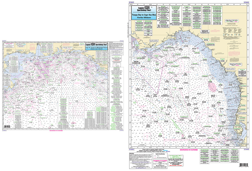
![Nearshore 20 - 30 miles off. Chart is 19 x 26 inches double sided and laminated Florida coastline
Side A: from Anna Maria Island to Tarpon Springs, with Tampa Bay and St. Joseph Sound. Side B: from Ancolte Keys to Crystal River. All charts include wrecks, reefs, shoals, rigs, fishing areas, amenities and restrictions. Please refer to our inshore, nearshore, offshore, and small boat/kayak charts in this area. Nearshore 20 - 30 miles off. Chart is 19 x 26 inches double sided and laminated Florida coastline
Side A: from Anna Maria Island to Tarpon Springs, with Tampa Bay and St. Joseph Sound. Side B: from Ancolte Keys to Crystal River. All charts include wrecks, reefs, shoals, rigs, fishing areas, amenities and restrictions. Please refer to our inshore, nearshore, offshore, and small boat/kayak charts in this area.](https://cdn11.bigcommerce.com/s-pr9amv4/images/stencil/200x200/products/36310/78947/TAM40z__61395.1523601674.jpg?c=2)
Captain Segull Chart - An offshore chart 90 to 100 miles off the coast. From Tampa Bay to the Mississippi River- LA. All charts include wrecks- reefs- shoals- fishing areas- amenities and restrictions
Offshore chart 90 to 100 miles off coast, Double sided, laminated, 19 x 26 inches. Florida, Alabama, Mississippi,& Louisiana
From Tampa Bay to the Mississippi River, LA. Includes the pipe lines, and all charts include wrecks, reefs, rigs, shoals, fishing areas, amenities and restrictions. Please refer to our inshore, nearshore and small boat/kayak charts in this area.