Welcome To Your Online Tackle Store!
We Have All The Best Tackle!
We Love Our Customers!
Welcome To Your Online Tackle Store!
We Have All The Best Tackle!
We Love Our Customers!
![]()
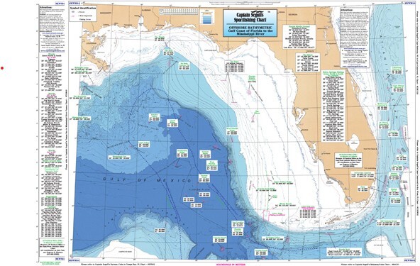

Captain Segull's Charts are designed for the serious sport fisherman. All charts are laminated, waterproof and in full color. Average chart size is 19" X 26". Captain Segull's Nautical Charts highlight: latitude and longitude (GPS), Loran lines, contour lines, shore services such as fuel docks, loading ramps, pump-out stations and restaurants. Also highlighted are fishing holes with local names, coordinates of buoys, inlets, and wrecks. Captain Segull's Fishing Charts cover the North American coastline from the Penobscot Bay, Maine south to Louisiana including Bahamas and Cuba and into the Gulf of Mexico!!! The ICW from Virginia down through Florida. Over 90 charts are available!