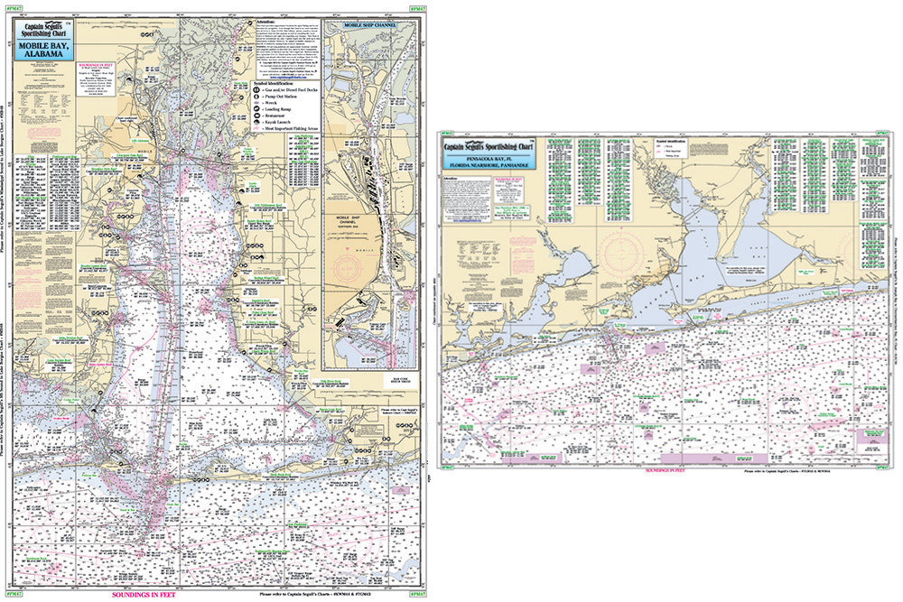
![Nearshore 20 - 30 miles off. Chart is 19 x 26 inches double sided and laminated Florida coastline
Side A: from Anna Maria Island to Tarpon Springs, with Tampa Bay and St. Joseph Sound. Side B: from Ancolte Keys to Crystal River. All charts include wrecks, reefs, shoals, rigs, fishing areas, amenities and restrictions. Please refer to our inshore, nearshore, offshore, and small boat/kayak charts in this area. Nearshore 20 - 30 miles off. Chart is 19 x 26 inches double sided and laminated Florida coastline
Side A: from Anna Maria Island to Tarpon Springs, with Tampa Bay and St. Joseph Sound. Side B: from Ancolte Keys to Crystal River. All charts include wrecks, reefs, shoals, rigs, fishing areas, amenities and restrictions. Please refer to our inshore, nearshore, offshore, and small boat/kayak charts in this area.](https://cdn11.bigcommerce.com/s-pr9amv4/images/stencil/200x200/products/36310/78947/TAM40z__61395.1523601674.jpg?c=2)
Captain Segull Chart - Nearshore Pensacola- FL and Mobile Bays- AL
Nearshore 20 - 30 miles off. Chart is 19 x 26 inches double sided and laminated Florida and Alabama coastline
Side A: from Wynne Haven Beach west to Romar Beach, includes Santa Rosa Sound, Pensacola Bay and Perdido Bay. Side B: from Romar Beach west to Bayou La Batre, includes all of Mobile Bay and an inset of the Mobile Ship Channel northern end. All charts include wrecks, reefs, rigs, shoals, fishing areas, amenities and restrictions. Please refer to our nearshore, offshore, and small boat/kayak charts in this area.