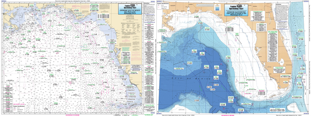
Product Description
Captain Segull Chart - Mississippi River Approaches and Delta
Bathymetric - color contoured by depth - Offshore 200 miles off the coast, double sided, laminated, 19 x 26 inces, Covers half the Gulf of Mexico
Side A: is a NOAA chart from Key West to the Mississippi River. Side B: is a Bathymetric chart from Key West to the Mississippi River. All charts include wrecks, reefs, rigs, shoals, fishing areas.